- EDITIONS:
 Spanish News Today
 Alicante Today
 Andalucia Today
PROPERTY SEARCH

Walking in the Lorca countryside, the Calares de Cambrón route in Avilés
A 13-kilometre route in Lorca which reaches around 1,350 metres above sea level
 This is a 13.5-kilometre walk in the environs of Áviles, a small village in the Tierras Altas area of the vast municipality of Lorca, which usually takes around 5 hours and is classified as being of level of difficulty 3.
The route starts at the spot known as Corral Chico, already at 900 metres above sea level, which is reached from Avilés by following Calle del Pardo past the church of San Nicolás de Bari and along the Camino del Cargador for 3.5 kilometres to a crossroads where the tarmac ends. Leave your vehicle here, making sure it does not block any of the paths and roads.
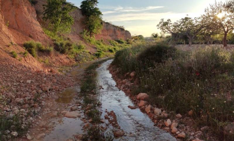
The walk begins by continuing along the Camino del Cargador, crossing the rambla after 1.5 km and taking the right fork after 2.5 km. This takes us along the edge of the mountains of the Sierra del Cambrón on a well-marked path, although it is necessary to cross from one side of the rambla to the other various times.
 After 4.7 km take a path which leads off to the left, passing a hexagonal water storage pool which belongs to the Casa de los Tornajos. After this take another path off to the right, where there are various Spanish fir trees and walkers pass a spring before climbing higher on a poorly marked path. This then joins the one which was left behind previously.
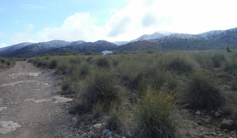
After 5.5 km this route joins the PR-MU 102 walk between Zarzadilla de Totana and the Morrón de Rivazuelo (the highest point of the municipality of Lorca at 1,531 metres above sea level) and the Pico de la Selva (just 10 metres lower and in the municipality of Bullas). Just 200 metres later we reach the Collado del Sudador at an altitude of 1,372 metres, with the path to the peak of Cambrón to the left and the PR-MU 102 route continuing to the right.
However, this route heads forward between the two of them, descending on a path which is easy to follow and winding round the Cambrón to La Hoya del Conejo after 8.1 km. Here we begin to make our way down to the gorge of the Barranco del Cargador. Following the Barranco we reach the point where it intersects with the other one which we climbed up, and from here follow our earlier route in the opposite direction to get back to the starting point.
For more visiting information, events and local news go to the home page of Lorca Today.