- EDITIONS:
 Spanish News Today
 Alicante Today
 Andalucia Today
PROPERTY SEARCH

PROPERTY SEARCH
The mountains of Sierra de la Pila in north-eastern Murcia
A protected Regional Park which has barely been altered by human activity over the millennia
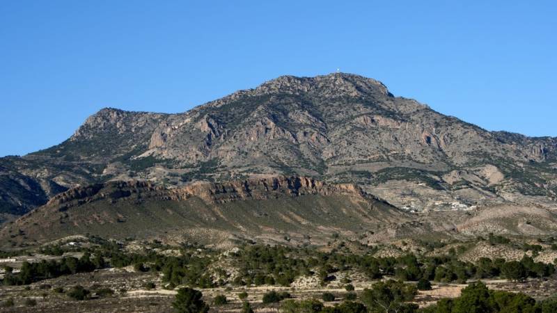 The Regional Park of the Sierra de la Pila is an area of 8,836 hectares in the north-east of the Region of Murcia, occupying parts of the municipalities of Abarán, Blanca, Fortuna, Molina de Segura and Jumilla, and is characterized by its abundant environmental, biological, geological and cultural diversity as well as its well-preserved natural condition.
Indeed, there are very few villages in the area, let alone towns and cities, although the villages of La Garapacha and Fuente Blanca (municipality of Fortuna) are within the boundaries of the park.
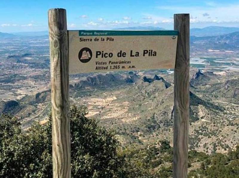
The highest point of the mountains is the Pico de la Pila at an altitude of 1,265 metres above sea level, closely followed by Los Cenajos (1,200m). Both of these are in the eastern part of the park, while in the larger western part the highest point is the peak of Caramucel at 1,023 metres above sea level and in all areas the mountains are characterized by steep slopes and layers of limestone, sandstone, dolomite and marl.
 Many of the rocks as we see them today have been sculpted by the forces of erosion over the last 20 million years, and there are numerous folds, faults, overhangs, caves, potholes and glacial deposits.
The climate is dry with an average annual rainfall of just 300 mm, hot in summer and cool and winter, although of course temperatures are lower on the highest ground and on north-facing slopes. The low rainfall is offset to a small degree by natural springs like the one of La Higuera, but on the other hand at the foot of the mountains an area of extremely arid “badlands”.
History
Given the sparse population of the area, there is little in the way of recorded history in the Sierra de la Pila, and the towns which do exist were founded by the Moors who ruled this part of Spain from the 8th to the 13th century. When Christian forces occupied Murcia in the 1240s this caused little in the way of immediate upheaval and agriculture continued to use Moorish techniques for centuries.
By the 14th century cattle farming had become the most important economic activity, and in later times both natural coal and irrigation farming made significant inroads. Hunting continued to support the population and in the 18th century a combination of coal, harvest crops, esparto grass, timber and aromatic plants brought relative prosperity to a poor region, forcing cattle farming to move onto higher and higher ground.
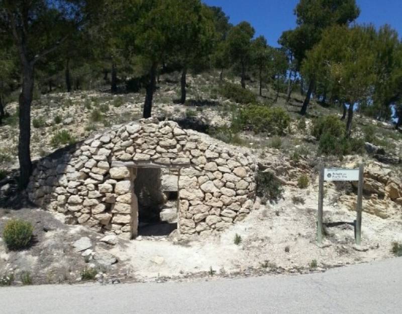
At the same time snow wells were built, supplying ice to the city of Murcia prior to the invention of refrigeration.
Attractions
Apart from the joy of absorbing the clean air and the sounds of Nature, the park is a popular area for hiking and cycling trips, and many visitors enjoy the climb to the peaks of La Pila and Los Cenajos. From here it is possible to watch the birds of prey circling the ground below, while at the other end of the spectrum other people are curious to discover caves such as the Cueva de la Excomunión, a favourite hideout of infamous bandit Jaime el Barbudo until he was executed in the Plaza Santo Domingo in Murcia in 1824.
Flora and fauna
The dominant kinds of vegetation in the Sierra de la Pila are Mediterranean oaks and juniper trees and bushes, although of course there are various other species in the area.

In terms of animals, the most eye-catching are doubtless the golden eagle, the peregrine falcon, the eagle owl and other birds of prey, leading to the area being categorized as a Birdlife Protection Zone (ZEPA). Other bird species include the red-beaked chough and red partridges, on top of which there are two species of bat and at least one invertebrate species of interest, the Cerambix cerdo beetle.
Among commonly seen mammals are the badger, the mountain cat, the genet and the beech marten.
Images: turismoregiondemurcia.es, SEO Birdlife, wikiloc