- Region
- Águilas
- Alhama de Murcia
- Jumilla
- Lorca
- Los Alcázares
- Mazarrón
- San Javier
-
ALL AREAS & TOWNS
- AREAS
- SOUTH WEST
- MAR MENOR
- MURCIA CITY & CENTRAL
- NORTH & NORTH WEST
- TOWNS
- Abanilla
- Abarán
- Aguilas
- Alamillo
- Alcantarilla
- Aledo
- Alhama de Murcia
- Archena
- Balsicas
- Blanca
- Bolnuevo
- Bullas
- Cañadas del Romero
- Cabo de Palos
- Calasparra
- Camping Bolnuevo
- Campo De Ricote
- Camposol
- Canada De La Lena
- Caravaca de la Cruz
- Cartagena
- Cehegin
- Ceuti
- Cieza
- Condado de Alhama
- Corvera
- Costa Cálida
- Cuevas De Almanzora
- Cuevas de Reyllo
- El Carmoli
- El Mojon
- El Molino (Puerto Lumbreras)
- El Pareton / Cantareros
- El Raso
- El Valle Golf Resort
- Fortuna
- Fuente Alamo
- Hacienda del Alamo Golf Resort
- Hacienda Riquelme Golf Resort
- Isla Plana
- Islas Menores & Mar de Cristal
- Jumilla
- La Azohia
- La Charca
- La Manga Club
- La Manga del Mar Menor
- La Pinilla
- La Puebla
- La Torre
- La Torre Golf Resort
- La Unión
- Las Palas
- Las Ramblas
- Las Ramblas Golf
- Las Torres de Cotillas
- Leiva
- Librilla
- Lo Pagan
- Lo Santiago
- Lorca
- Lorquí
- Los Alcázares
- Los Balcones
- Los Belones
- Los Canovas
- Los Nietos
- Los Perez (Tallante)
- Los Urrutias
- Los Ventorrillos
- Mar De Cristal
- Mar Menor
- Mar Menor Golf Resort
- Mazarrón
- Mazarrón Country Club
- Molina de Segura
- Moratalla
- Mula
- Murcia City
- Murcia Property
- Pareton
- Peraleja Golf Resort
- Perin
- Pilar de la Horadada
- Pinar de Campoverde
- Pinoso
- Playa Honda
- Playa Honda / Playa Paraíso
- Pliego
- Portmán
- Pozo Estrecho
- Puerto de Mazarrón
- Puerto Lumbreras
- Puntas De Calnegre
- Region of Murcia
- Ricote
- Roda Golf Resort
- Roldan
- Roldan and Lo Ferro
- San Javier
- San Pedro del Pinatar
- Santiago de la Ribera
- Sierra Espuña
- Sucina
- Tallante
- Terrazas de la Torre Golf Resort
- Torre Pacheco
- Totana
- What's On Weekly Bulletin
- Yecla


- EDITIONS:
 Spanish News Today
 Alicante Today
 Andalucia Today
The Cejo Colorao hiking route around Zarzadilla de Totana
A testing 17-kilometre walk in the mountains and valleys of the north Lorca countryside
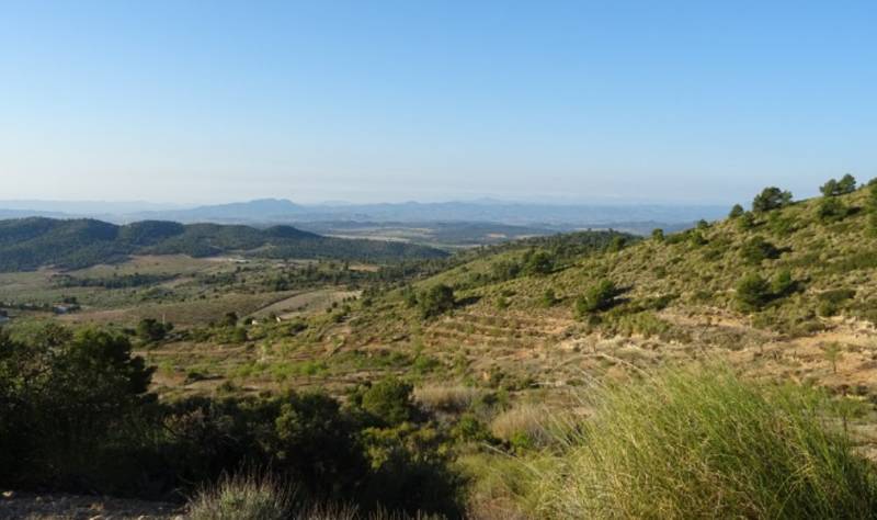
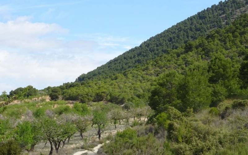
 Zarzadilla de Totana is a village in the “Tierras Altas” area of the vast municipality of Lorca, on the high ground between Lorca to the south and Bullas, Caravaca de la Cruz and Cehegín to the north. It nestles at the foot of the mountains of Sierra de Pedro Ponce, one of the most mountainous areas of Lorca, and takes its name from the abundant “zarza” plants (brambles) which characterize the local vegetation. However, it is also home to plenty of vines, pines and almond trees, and grapes and almonds are a staple of the modest local economy.
The Sierra de Pedro Ponce has been declared part of the Sierra de Burete a birdlife protection zone (ZEPA) and is home to species such as the golden eagle, the booted eagle, the short-toed snake eagle, the buzzard and the griffon vulture.
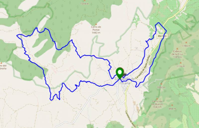
 The walk begins by heading west out of Zarzarilla, leaving the tarmac after 800 metres to start a sharp climb, at the top of which a path on the left takes us to an altitude of 943 m after just 2 kilometres. The route then goes down towards the Rambla del Madroño and past the dwelling known as the Cortijo del Madroño Bajo (km 4.5), which stands next to a spring.
After 6.15 km the altitude rises to 987 metres above sea level, and turning right here walkers head towards El Frailecico, after which there is a steep 17% climb. After the descent a path leads towards El Nacimiento and then back into the village once more: probably a good moment for a rest and a bite to eat!
 The second (optional) part of the route heads out to the east and north-east, including the foothills of the Cabezo de la Cruz and then the Collado de las Burras before returning to Zarzadilla.
For more local activities, events, news and visiting information go to the home page of Lorca Today.


