Date Published: 20/01/2025
Storm Garoé brings torrential rain: Spain weather forecast Jan 20-23
Spain will be one of the wettest countries in Europe this week thanks to a succession of incoming storms
Rain expected on Tuesday morning
The first to make landfall will be Storm Garoé, which will sweep past Portugal to hit the Atlantic coast of Spain on Monday afternoon, January 20, travelling from Galicia to western
Andalucía.
The State Meteorological Agency (Aemet) has confirmed that Garoé is the seventh ‘high-impact’ storm of the 2024/2025 season.
By Tuesday, the rain will have already spread to many areas, although the bad weather is not expected to reach the Mediterranean, and by Wednesday, much of Spain will be under a deluge of rain.
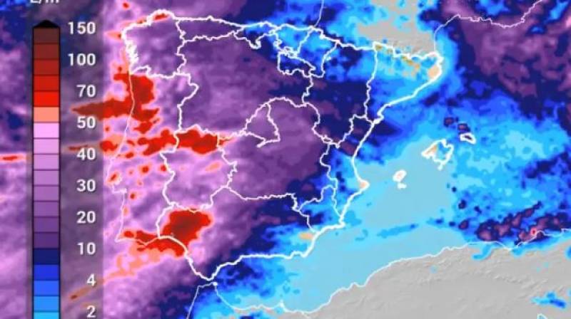
Some of the heaviest rain will hit the west of Andalucía, where between 100 and 150 litres per square metre are expected to accumulate.
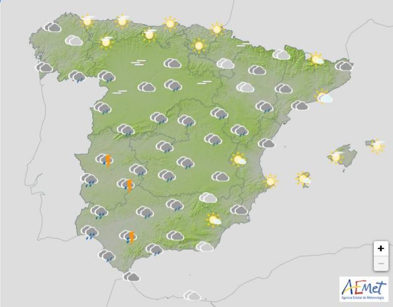
Monday January 20
As the storm approaches, the entire country can expect cloudy or overcast skies on Monday. While most of Spain can expect at least some showers, the worst is forecast in the southwest.
Daytime temperatures should creep up slightly, hitting the high teens in much of southern Spain and the night will also be milder, driving away the frosts of last week.
Yellow weather warnings for rainfall have been activated in Andalucía and Extremadura while alerts for snowfall have been issued in Castilla y León, Castilla-La Mancha, Catalonia, Madrid, La Rioja and Navarra.
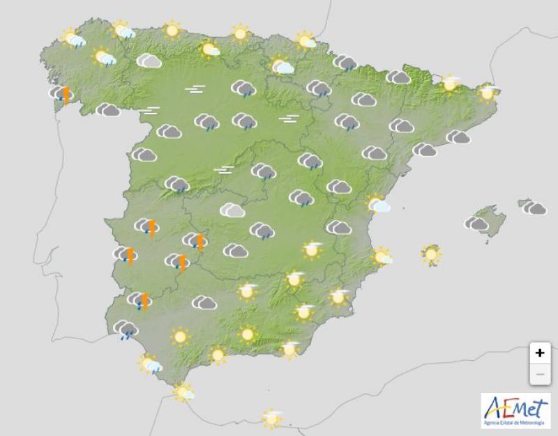
Tuesday January 21
Once again, all of Spain can expect some rain on Tuesday, although it should remain dry along the Mediterranean coast. Cloudy or overcast skies are forecast with stormy downpours in Galicia and the southwest, namely Andalucía.
Both day and night-time temperatures will increase across the board.
The yellow rain warnings remain in place in Andalucía and Extremadura.
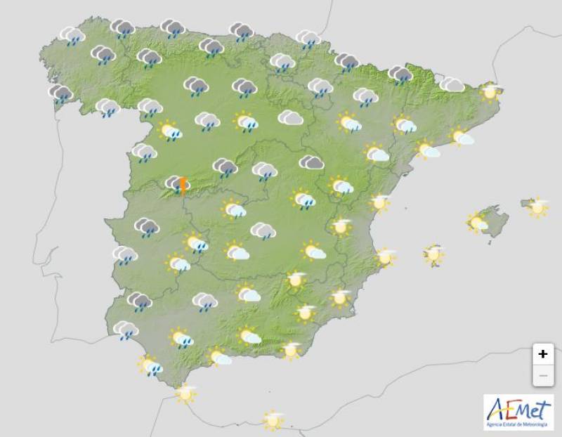
Wednesday January 22
The situation of instability is expected to persist under the influence of the Storm Garoé and its fronts, which will leave cloudy or overcast skies and widespread rainfall. The most abundant rainfall is expected in western Galicia and in the southern half of the Atlantic slope, where it could be locally strong and accompanied by storms.
Daytime temperatures will fall in Andalucía, the Canary Islands and the west of the country in general, but the thermometers should rise elsewhere, climbing into the 20s in the likes of
Alicante and
Murcia.
The yellow rain warnings remain in place in Andalucía and Extremadura.
Thursday January 23
The weather should begin to settle down on Thursday morning as Storm Garoé moves away, although the remains of its fronts may still affect large areas of the country. Cloudy skies are expected, with a tendency to clear as the hours go by, and it will be much drier than previous days. Even so, it will still be a wet day in large parts of inland Spain and along the Strait.
An almost general drop in temperatures is expected, except on the Mediterranean coasts.
All of the weather alerts have been lifted on Thursday.
Images: Meteored/Aemet
article_detail

|


