- EDITIONS:
 Spanish News Today
 Alicante Today
 Andalucia Today
PROPERTY SEARCH

PROPERTY SEARCH
A great walk up the castle hill of Yecla and through the old town
An easy and healthy way to walk through the history of Yecla!
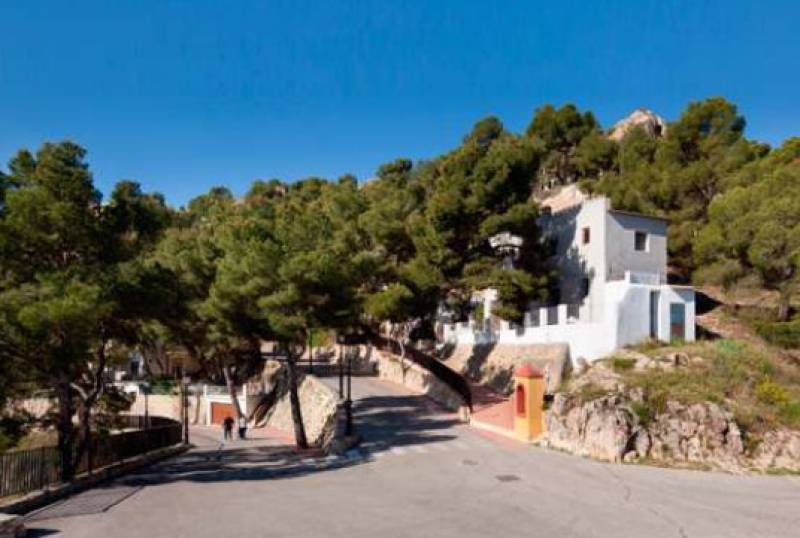 This pleasant 5.2-kilometre walking route in Yecla takes around an hour and a quarter and includes a climb up the Cerro de Castillo, where the sanctuary and the remains of the castle can be seen and there are great views over the centre and the surrounding countryside, then crossing the town to return to the starting point at the Edificio Bioclimático.
Medieval Yecla
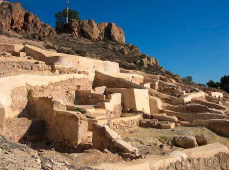
At the top of the Cerro del Castillo are the remains of a medieval Islamic/Moorish fortress, known in the middle of the 12th century as “Hisn Yakka”. Close to the walls of the castle you can visit the houses of the village associated with this fortress.
 Late Medieval Yecla, which dates back to the 15th and 16th centuries, is located adjacent to the northern slope of Cerro del Castillo, where the current neighbourhood of San Cristóbal was the Jewish quarter and the Christian area was based around the Old Church and grew in the direction of Santa Bárbara Hill. Today these streets are narrow and winding, some of them with steep gradients due to the local topography.
The suggested route is as follows, starting and ending at the Edificio Bioclimático:
From the Edificio Bioclimático, walk a few minutes until reaching the cemetery and then follow the Paseo del Yeclano Ausente. After a few steep uphill curves you arrive at the top of the Cerro del Castillo, where you can see the sanctuary of La Virgen del Castillo and the remains of the Islamic settlement Hisn Yakka.
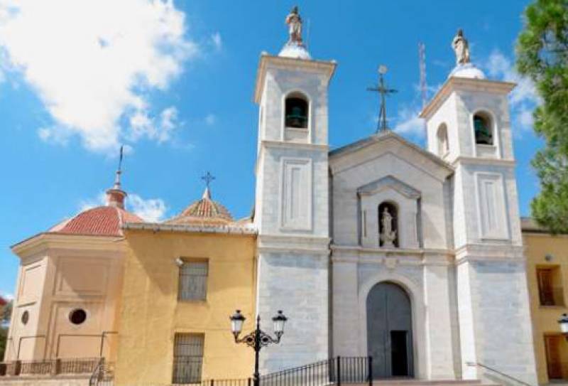
Now go down from the sanctuary along the winding Paseo del Barco de Ávila until you reach the back of the church of La Asunción, commonly known as the Old Church. From here, leave the main road and go straight down Calle de Isabel la Católica. A few metres down take a curve to the right that leads you to Calle Tetuán. Continue west along the old, narrow, winding streets, passing Colegio de La Pedrera, and then turn left towards Las Herratillas health centre and Felipe VI secondary school. At the next crossroads take a sharp turn down Calle Hernán Cortés.
Here there is a viewpoint that allows you to take a break.
 Once past La Pedrera school, on Calle Algeciras, you can take a detour from the route on Calle Peñón, along which is an intriguing little square: the Placeta Cerro de Santa Barbara, a calm and secluded site with interesting panoramic views of the oldest and most remote Yecla.
Calle Hernán Cortés is the closest road to the Old Town that goes end-to-end through Yecla. After passing by Las Herratillas school, climb a few steps surrounding the church of Santa Bárbara and walk down down Calle Santa Bárbara, reaching the pedestrian street Calle del Niño (which becomes Calle Hospital), finally reaching the Cruz de Piedra. This is a great cross that joins Calle Hospital and Calle Corredera, and it is the beginning of Calle Cruz de Piedra.
Once past the Cruz de Piedra, at the next corner turn up Calle de San Isidro, which leads back to the cemetery (on Calle Abad José Sola) and then the the Edificio Bioclimático.
Full details of the route (and a map) can be found on the tourist office’s leaflet here – in English as well as Spanish!
If visiting Yecla don’t forget to make sure one of your first ports of call is the tourist office (Plaza Mayor, 1, email turismo@yecla.es, telephone 968 754104).
For more local events, news and visiting information go to the home page of Yecla Today